Farm Roads and Old Towns in the Greenbrier Valley
I pulled out of Charleston at twenty past six with a light frost on the windshield and a forecast that promised fifty-eight by three in the afternoon. The Greenbrier Valley runs about 110 miles east of my driveway, and the last twenty of those miles change the ground under you completely. Coal country gives way to limestone, and limestone gives way to open farms.
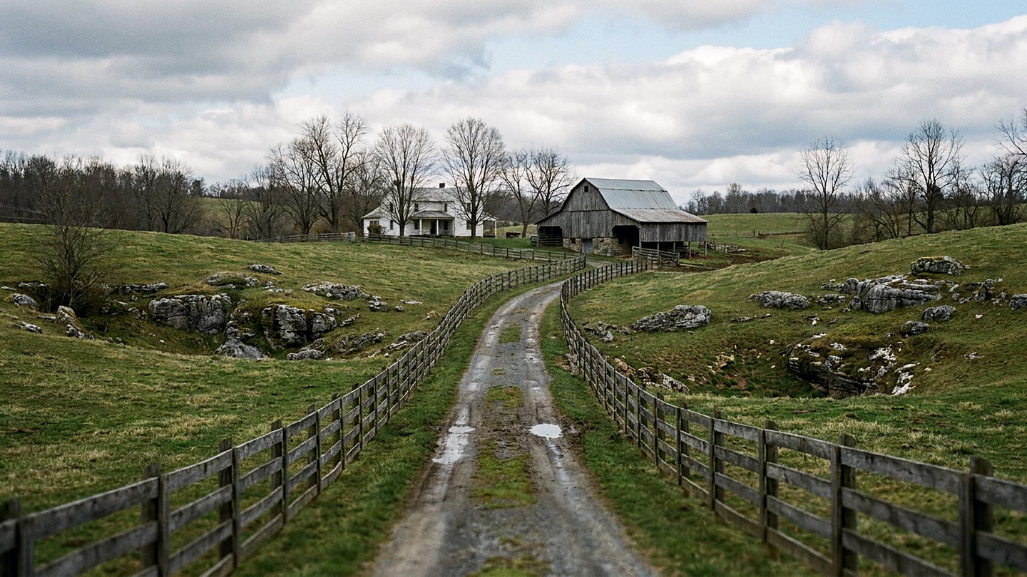
I go over there in the last week of March because that is when the valley floor turns before the hills do. The pastures come green while the ridges above them are still the color of a paper sack. For about ten days the two sit side by side, and you can see exactly where the warm ground stops.
This was a driving day with short walks in it. I wanted numbered farm routes, two old towns, and enough time standing in a field to hear what was moving.
Coming into the valley
Interstate 64 east out of Charleston climbs and drops for an hour before it gets serious about elevation. Past Beckley the road runs over a set of long grades, and at Sandstone the New River shows itself briefly below the bridge. Then comes the pull over Sewell Mountain, which was in cloud at the top and clear again by the bottom.
The Lewisburg exit came at quarter past eight, one hour and fifty-five minutes from my driveway. Coming down the ramp you are already in a different country. The land opens out into wide bottoms, the fence lines run straight for half a mile at a stretch, and the barns are bigger than the houses.
I stopped first on a pull-off along US 219 north of town, which put me at about 2,100 feet with a view over eight or ten fields. A killdeer worked the stubble twenty yards off and did not care about the truck. Two tractors were out in the bottomland turning ground, and the smell of that reached me before I saw them.
Farm roads north
US 219 runs north from Lewisburg through Frankford and on toward Renick, and the numbered county routes come off it every mile or so. I took three of them on this trip, all gravel or chip seal, all one and a half lanes wide. The rule on those lanes is simple: drive slow enough to back up when a truck comes the other way.
Frankford is a crossroads with a handful of buildings and a good long view south. North of it the road drops toward the Greenbrier River, and the fields on the river side were the greenest ground I saw all day. Lambs were out in two pastures, and a bottom that had been in corn was disked flat and waiting.
At Renick I parked at the public access to the rail trail and walked north for twenty-five minutes. The surface there is packed crushed limestone, level and easy, with the river close on the right for most of it. Spring beauties were up in the leaf litter, and one bloodroot was open where the sun cleared the bank.
Coming back south I let myself get lost on purpose for about half an hour. Every wrong turn ended at a gate, a barn, or a ledge of gray rock with a fence stapled along the top of it.
Two towns on the river
Lewisburg has brick streets in the older blocks and a courthouse square that still works as a square. I walked Washington Street for forty minutes, going slow past storefronts that were built for a different traffic pattern. The historical society keeps a house museum on that street, and Greenbrier County was organized here in 1778.
Ronceverte sits five miles south, down on the flat by the water, and it reads as what it was. This was a lumber and rail town, and the shape of the yard is still legible even where the tracks are gone. The name is French for green brier, which is also the river, which is also the county.
From there WV 63 runs west along the river through Fort Spring to Alderson. That is twelve miles of good two-lane with the water in and out of view the whole way. I got to Alderson at twenty till three and spent twenty minutes on the concrete arch bridge that has carried traffic across the Greenbrier since 1914.
The town sits on both banks, half in one county and half in another. Standing at the middle of that bridge, you can watch the current work around the piers and hear a train two ridges over.
What the rock does
Everything about that valley comes back to limestone under thin soil. The ledges come up through the pastures in gray ribs, and the farmers fence to the rock rather than fighting it. Sinkholes sit in the middle of good ground, each one usually holding a single tree that never got mowed around.
Water behaves differently there than it does at home. Creeks run strong for a mile and then go under, and springs come out of hillsides at a steady cool temperature all year. I stood at one small opening off a county route and felt the air coming out of it, which was easily fifteen degrees colder than the field.
That rock is also why the fields green early. Limestone soil drains fast and warms fast, so the valley floor gets a head start on the ridges above it. By the last day of March the difference was as clear as a line drawn on the hillside.
What it came to
Eleven hours door to door, 288 miles, and two hours and fifty minutes out of the truck. Driving took six hours and forty minutes. The rest went to a long midday break and to towns where I moved at the pace of the traffic. Most of that mileage is interstate on both ends, which is what a valley that far east asks of you.
This one will not suit everybody. The gravel lanes are narrow, the turnarounds are somebody's driveway, and the ledges make for uneven footing if you step off the shoulder. There is very little shade on the open routes, and the wind on those bottoms does not quit.
If you want one town instead of three, take Lewisburg and give it a whole afternoon on foot. If you want the farm country, go on a weekday morning and keep your speed down. Everything worth seeing out there is visible from a public road, and none of it needs you to open a gate.
I was home at twenty past five with two and a half hours of daylight still on the yard. That is what the last week of March gives you over February.
The count
- Time out of the truck 2 hours 50 minutes
- Driving 6 hours 40 minutes
- Daylight left when I parked at home 2 hours 30 minutes
Checked against
- County commission pages for road numbers, districts, and public access points
- County historical society pages for town founding dates and the rail years
- State road logs for the numbered farm routes north and west of Lewisburg
- Regional forecast pages from the national weather service office

Wes CardwellFounder and editor. Charleston, West Virginia. Every trip on this site was driven, walked, and timed by hand.