A Day at the Cranberry Glades Boardwalk
I have driven the corridor up Cranberry Mountain in February, when the high road is gated and the wind runs the ridge unopposed. On April twenty-eighth I drove the same miles and found a different place waiting at the top. The gate was open, the lot was gravel instead of packed snow, and the bowl below the road was full of fog.
The glades themselves are a bog system in a high Pocahontas County basin, and the public deck runs about half a mile. That is a short walk by any measure, which is why the trip is mostly road. You spend better than five hours driving to spend eighty-five minutes on wood.
I would drive it again without thinking about it twice. There is nothing else in the state that looks or smells like that basin at nine in the morning.
The way in
I left Charleston at ten till seven with the temperature at forty-four and a low ceiling over the river. Interstate 79 north to Sutton, then US 19 south to Summersville, took just under two hours with one stop. WV 39 east from Summersville is the long part, thirty-five miles of two-lane through Craigsville, Fenwick, and Nettie.
Past Richwood the road becomes WV 39 and 55 together and climbs about nine miles to the top of Cranberry Mountain. In April that grade is wet more often than not, with rock fall gravel swept to the edges and a lot of new leaf overhead. Two logging trucks came down while I was going up, and both of them owned the middle of the road.
The turn for the glades is Forest Road 102, heading north off the highway a short way west of the nature center. It runs a bit over a mile to the parking area, paved and narrow, with the ditch line close on both sides. I pulled in at nine thirty-five and there were two other vehicles in the lot.
On the way back out I stopped at the nature center, which opens for its season in the spring. The exhibit room is small and plain, with a relief model of the basin and cases of pressed plants. A staffer answered two of my questions about the peat and did not pretend to know a third.
Fog in the bowl
The basin sits at about 3,400 feet and it holds cold air the way a bowl holds water. My truck read thirty-six degrees at the lot, twelve degrees colder than Richwood twenty minutes behind me. There was frost on the wooden rail at the trailhead and none at all in the trees on the way up.
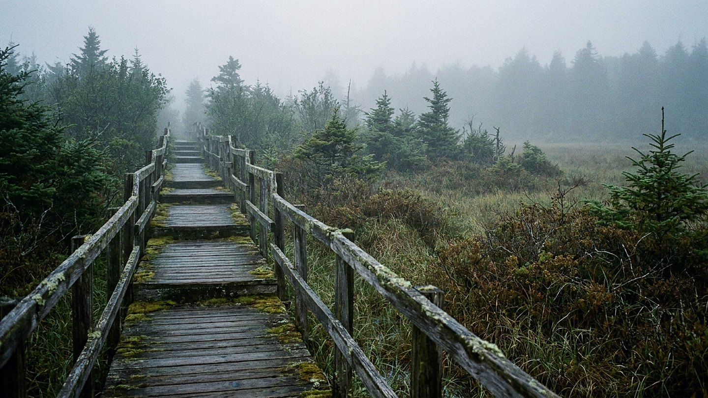
The fog was sitting on the open glades in a flat layer maybe fifteen feet deep. From the first few yards of deck I could see the moss underfoot clearly and nothing at all a hundred feet out. That lasted until about twenty past ten, when the sun cleared the ridge and started taking it apart in pieces.
Sound carries strangely in that condition. A winter wren was going somewhere off to the left, loud and long, and I never did see the bird. A hermit thrush answered from the spruce on the far edge, and between them the basin was as quiet as any place I know.
Half a mile of deck
The boardwalk is plain treated lumber, low to the ground, with a rail on the sections that cross open water. It runs level the entire way, and I did not find a single step on it. That is unusual for public ground at that elevation and it is the reason people of every ability get to see this.
The deck crosses two kinds of ground. The first is open bog, a spongy mat of sphagnum moss with cranberry vines threaded through it and standing water underneath. The second is a low shrubby fringe and then spruce, where the wood runs through shade and the air goes cold again.
Under the moss, that mat is peat, and it builds at something like an inch a century. The signs make that point and the point lands harder when you are standing on it. Everything you can see from the deck took longer to grow than the state has existed.
I went slowly and still finished the loop in thirty-five minutes. Then I went again, which took fifty, because the fog had lifted and the whole basin had opened up.
What grows there, and the rules
Late April is early for the show. The skunk cabbage was well up in the wet spots, buckbean was showing at the edge of the open water, and the sphagnum was every color from rust to pale green. The orchids that people come for, grass pink and rose pogonia, do not open until June.
The plants that make this place unusual are the ones that feed on insects. Purple pitcher plants sit low in the moss with their leaves holding rainwater, and sundew spreads sticky red hairs across a leaf the size of a fingernail. Both live here because bog water gives them almost nothing to work with.
The reason all of this survives at that latitude is elevation and cold air together. The basin drains poorly, the water stays acid, and the growing season runs short even in a good year. Plants that belong several hundred miles north hung on here after the ice pulled back, and they never left.
The rules are posted at the trailhead and they are short. Stay on the boardwalk, do not pick or dig anything, keep pets leashed, and pack out whatever you carry in. The reason for the first rule is simple: a boot print in that mat can still be visible years later.
I watched two people photograph a pitcher plant from the deck with a long lens, which is exactly how that is done. Nobody stepped off the whole time I was there.
What it came to
Eight hours door to door, 262 miles, and two hours and fifteen minutes out of the truck. Eighty-five minutes of that was on the deck itself, and the rest went to the lot, the nature center, and one long look from the highway pull-off.
Some notes for anybody going. There is no shade at all on the open sections and no shelter if weather comes in fast. The lot fills on summer weekends, the mosquitoes get earnest by late May, and the basin can drop below freezing in any month of the year.
If you have limited walking in you, this is one of the few high places in the state that will still work. The deck is level, the loop is short, and you can turn back at any point without missing much. If you want the flowers rather than the fog, come in the third week of June instead.
I was home at ten till three with five and a half hours of daylight left. That is the difference between late April and the February version of the same road.
The count
- Time out of the truck 2 hours 15 minutes
- Driving 5 hours 35 minutes
- Daylight left when I parked at home 5 hours 30 minutes
Checked against
- Boardwalk length, elevation, and access notes on the national forest pages
- Plant lists and seasonal bloom notes from the nature center pages
- Posted conduct rules for the botanical area on the national forest pages
- Opening dates for the nature center season, from the same pages

Wes CardwellFounder and editor. Charleston, West Virginia. Every trip on this site was driven, walked, and timed by hand.